Severe Weather Outlook
Hayley here - Do you want to see severe weather in your calendar?
* it's like an add-on for your digital calendar NOT a paper calendar
National Severe Weather Outlook for the next week
Here you'll find all available severe weather outlooks on one page.
Overview of the threat for the next few days
Outlook for Tuesday, October 13
Outlook Summary
Widely scattered severe storms capable of large hail, damaging winds, and possibly a tornado are expected over portions of the central and southern Plains into the Lower Missouri Valley this afternoon into tonight. More isolated severe weather may occur from southwest Texas into the mid Mississippi Valley, and in parts of New York.
Outlook Images
overview

tornado 5%

wind 15%

hail 15%

Detailed Outlook
← back to overviewSPC AC 131252
Day 1 Convective Outlook NWS Storm Prediction Center Norman OK 0752 AM CDT Tue Oct 13 2026
Valid 131300Z - 141200Z
THERE IS A SLIGHT RISK OF SEVERE THUNDERSTORMS FROM PARTS OF NORTHWEST MISSOURI/KANSAS INTO THE SOUTHERN HIGH PLAINS
### SUMMARY
Widely scattered severe storms capable of large hail, damaging winds, and possibly a tornado are expected over portions of the central and southern Plains into the Lower Missouri Valley this afternoon into tonight. More isolated severe weather may occur from southwest Texas into the mid Mississippi Valley, and in parts of New York.
Southern High Plains through the south-central Plains into the Midwest
Early morning satellite imagery shows a belt of moderate to strong southwesterly flow aloft from the Southwest across the central Plains, situated between a slow-moving upper low over the western Great Basin and expansive upper ridging centered over the upper TX/western LA coast. Based on recent mesoanalysis, the strongest portion of this southwesterly flow currently extends from the southern AZ/NM border into south-central CO, colocated with a low-amplitude shortwave trough. Recent surface analysis places a pair of lows just downstream of this stronger flow aloft, one over southeast CO and the other over central KS. A cold front connects these two lows and continues northeastward from the central KS low to another low over northern Lake Michigan. Airmass south of this low is very moist, with upper 60s reaching into south-central KS and low 70s dewpoints reaching up through central OK.
Expectation is for the embedded shortwave trough to progress quickly northeastward today, reaching the central High Plains by late this afternoon before continuing northeastward through the central Plains this evening. As it does, the frontal zone across KS will sharpen and initially southwesterly surface winds will back, becoming more southerly (perhaps even slightly southeasterly) by the late afternoon. Strong heating is anticipated along and south of the front as well, with afternoon temperatures in the low 90s. Any boundary-layer mixing will be offset by continued low-level moisture advection, with afternoon dewpoints likely remaining in the mid to upper 60s along the front in KS and east of the dryline in the eastern TX Panhandle. These conditions are expected to result in airmass destabilization around 21Z. Lapse rates will be not be overly steep, but warm and moist low-levels will still result in moderate to strong buoyancy.
Increasing convergence along the front and dryline within this destabilized and buoyant airmass is forecast to result in convective initiation. The strongest mid-level flow will be displaced north and west of the frontal zone, but mid-level flow along and south of the front should still be strong enough to support moderate deep-layer vertical shear and the potential for an initially supercellular storm mode. Strong to severe gusts and large hail are expected to be the primary hazards. A few gusts from 65 to 75 mph are possible. Tornado potential will remain low, but ample low-level moisture coupled with an increase in low-level shear/SRH by early evening could result in a tornado or two near the front. Modest upscale growth will be possible later tonight across parts of KS/MO and western/southern IL. However, the severe threat should become more isolated with time given increasing nocturnal stabilization and widespread storm interactions.
Parts of western/central NY
A low-amplitude midlevel shortwave trough will continue to move quickly eastward through eastern Ontario through the Northeast today. An attendant surface low will eastward just ahead of the parent shortwave. Increasing low-level moisture and afternoon temperatures in the upper 70s will promote modest buoyancy, although clouds/precipitation and relatively warm low to mid-level temperatures result in some uncertainty regarding airmass destabilization.
Increasing deep-layer westerly flow (particularly around 850 mb) amid low-level southwesterlies will result in notably curved low-level hodographs. As a result, any sustained surface-based storms could organize, supporting a threat for localized wind damage and possibly a brief tornado. Modest buoyancy is expected to limit the overall magnitude and coverage of the severe potential.
..Mosier/Wendt.. 10/13/2026
CLICK TO GET WUUS01 PTSDY1 PRODUCT
NOTE: THE NEXT DAY 1 OUTLOOK IS SCHEDULED BY 1630Z
Outlook for Wednesday, October 14
Outlook Summary
Isolated severe thunderstorms capable of mainly damaging wind gusts are possible across portions of the southern Plains into the Ozark Plateau, and in the parts of the upper Ohio Valley and Mid-Atlantic Wednesday afternoon and evening.
Outlook Images
overview

tornado low

wind 5%

hail 5%

Detailed Outlook
← back to overviewSPC AC 130515
Day 2 Convective Outlook NWS Storm Prediction Center Norman OK 1215 AM CDT Tue Oct 13 2026
Valid 141200Z - 151200Z
THERE IS A MARGINAL RISK OF SEVERE THUNDERSTORMS ACROSS PORTIONS OF THE SOUTHERN PLAINS INTO THE OZARK PLATEAU…AND IN PARTS OF THE UPPER OHIO VALLEY AND MID-ATLANTIC
### SUMMARY
Isolated severe thunderstorms capable of mainly damaging wind gusts are possible across portions of the southern Plains into the Ozark Plateau, and in the parts of the upper Ohio Valley and Mid-Atlantic Wednesday afternoon and evening.
Synopsis
An upper low centered near the Four Corners Wednesday morning is forecast to gradually weaken while progressing into the central High Plains by early Thursday. Within the southeast periphery of the low, a vorticity maximum is expected to advance from the southern Rockies into the central High Plains in tandem with a 50-60 kt jet streak in the mid levels. Elsewhere, a series of vorticity maxima (some of convective origin) are forecast to translate from the mid-MS Valley to the southern Mid-Atlantic. At the surface, a cold front will move south through the Mid-Atlantic, OH and mid-MS Valleys, and into portions of the southern Plains. The western segment of the front over the southern Plains may eventually stall and perhaps retreat north Wednesday night in response to falling pressures over the central Plains.
### Southern Plains into the Ozark Plateau
Showers and thunderstorms are expected to be ongoing at 12Z Wednesday, along and ahead of the cold front, aided by modest warm advection and moisture transport along a weakening nocturnal low-level jet. The presence of a seasonably moist (e.g., dewpoints in the mid 60s to mid 70s F) and at least marginally unstable air mass will likely support the continuation of showers and thunderstorms through the day in some areas. On the southern fringe of any more persistent clouds and precipitation, stronger heating may contribute to corridors of moderate instability by afternoon where MLCAPE may approach 1500-2000 J/kg. That destabilization process will coincide with strengthening vertical shear and forcing for ascent preceding the southern Rockies disturbance, yielding an environment supportive of isolated strong to severe storms during the afternoon and evening. Damaging wind gusts appear to be the primary hazard with the best potential for a few occurrences of severe hail being in southwest TX.
### Upper Ohio Valley into the Mid-Atlantic
Daytime heating combined with boundary-layer dewpoints in the mid 60s to low 70s F is expected to contribute to pockets of moderate instability with MLCAPE approaching 1000-1250 J/kg by mid-late afternoon ahead of the cold front. Aided by forcing for ascent preceding the series of vorticity maxima approaching from the west, thunderstorms are expected to develop and subsequently increase in areal coverage along the front at that time. Steepening low-level lapse rates coupled with strengthening west-southwesterly winds with height (yielding up to 35-40 kt of deep-layer shear) appear supportive of isolated severe storms capable of damaging wind gusts into evening.
..Mead.. 10/13/2026
CLICK TO GET WUUS02 PTSDY2 PRODUCT
NOTE: THE NEXT DAY 2 OUTLOOK IS SCHEDULED BY 1730Z
Outlook for Thursday, October 15
Outlook Summary
Isolated severe storms appear possible over portions of the mid- Mississippi and Ohio Valleys Thursday afternoon through night.
Outlook Images
overview

any severe 5%

Detailed Outlook
← back to overviewSPC AC 130708
Day 3 Convective Outlook NWS Storm Prediction Center Norman OK 0208 AM CDT Tue Oct 13 2026
Valid 151200Z - 161200Z
THERE IS A MARGINAL RISK OF SEVERE THUNDERSTORMS OVER PORTIONS OF THE MID-MISSISSIPPI AND OHIO VALLEYS
### SUMMARY
Isolated severe storms appear possible over portions of the mid- Mississippi and Ohio Valleys Thursday afternoon through night.
Synopsis
A short-wave trough over SK/MB Thursday morning is forecast to undergo considerable amplification while translating into the Great Lakes late Thursday night/early Friday. Ahead of that feature, an upper low will weaken into an increasingly sheared open wave while accelerating from the central High Plains into the Midwest. At the surface, an area of low pressure is expected to develop along a poleward-advancing warm front from central or eastern KS through the mid-MS and OH Valleys to the lower Great Lakes. Meanwhile a trailing cold front will surge south through much of the southern Plains and into the lower-MS Valley.
### Mid-Mississippi and Ohio Valleys
Showers and thunderstorms may be ongoing at 12Z Thursday from portions of the central Plains into the mid-MS Valley within a zone of warm-air and moisture advection preceding the surface low. A subset of the early-day storms may persist through the day with associated cloud cover limiting daytime heating and resultant air mass destabilization in those areas. Where cloud breaks can occur, stronger diabatic heating coupled with boundary-layer dewpoints in the low to mid 70s may contribute to a corridor of moderate instability by afternoon, which would become a preferred zone of diurnally enhanced thunderstorm development.
Both vertical shear and forcing for ascent are forecast to steadily strengthen from Thursday afternoon through night, leading to the potential for a fast-moving complex of storms to traverse the region with an associated risk for locally damaging wind gusts.
..Mead.. 10/13/2026
CLICK TO GET WUUS03 PTSDY3 PRODUCT
NOTE: THE NEXT DAY 3 OUTLOOK IS SCHEDULED BY 1930Z
Outlook for Friday, October 16
Outlook Images
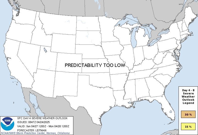
any severe predictability too low
Note on Medium Range Outlooks
You are looking at an outlook that is part of the medium range forecast (the outlook for days 4-8). The most important thing to note is that lack of a risk does not mean zero risk. Generally speaking, confidence has to be pretty high for the Storm Prediction Center to have an outlook area this far into the future.
When no specific risk areas are shown, you might see one of these phrases:
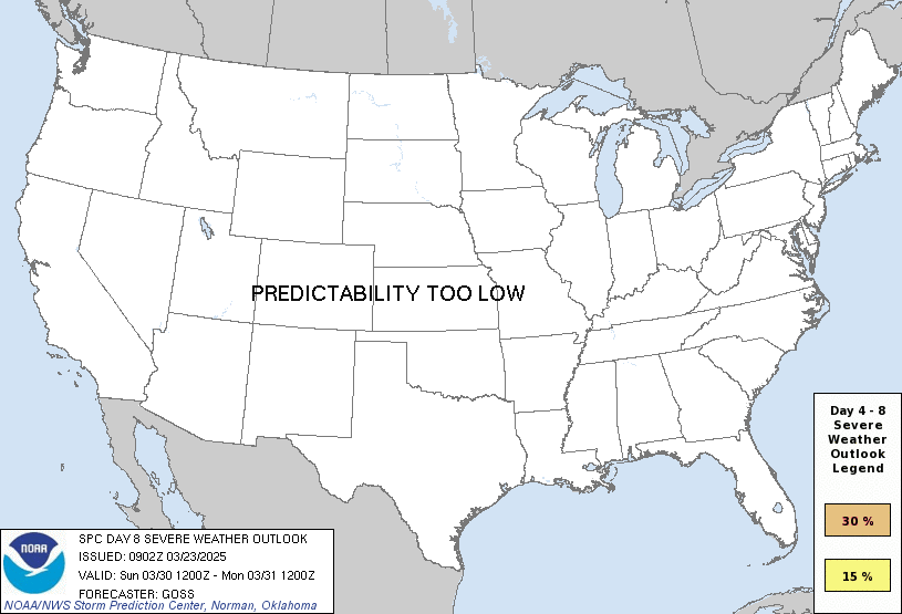
- Predictability Too Low: This means that severe storms might be possible, but forecasters aren't confident enough about where or when they might occur. Think of it as the models showing different possibilities, like pieces of a puzzle that haven't come together yet.
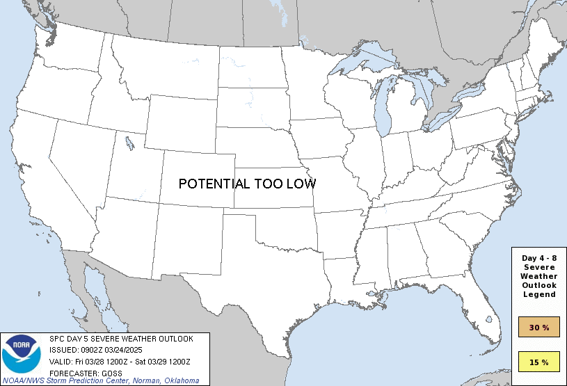
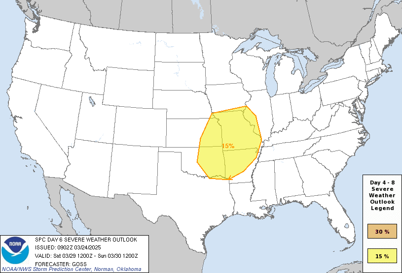
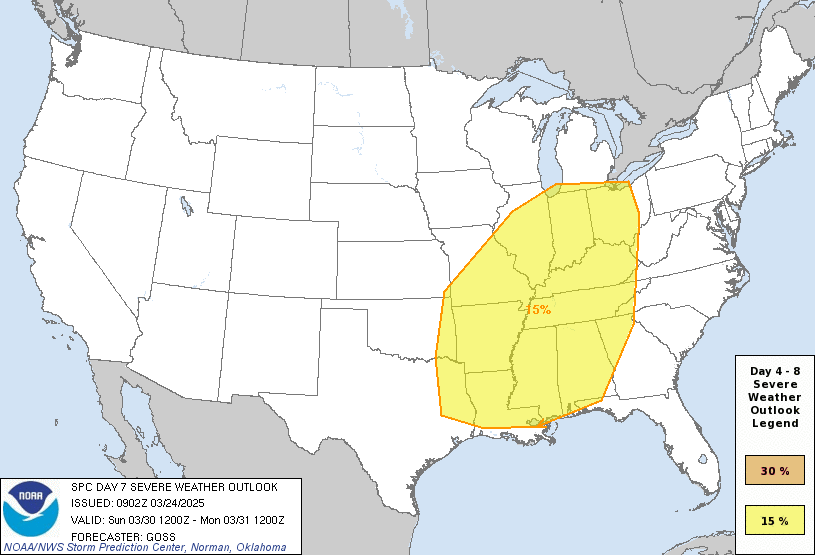
- Potential Too Low: This means forecasters are fairly confident that widespread severe weather is NOT expected on that day. While isolated storms might still occur, the chance of reaching severe criteria across any given area is very low.
If you bookmark this page, it will continue to update with each new outlook that is issued.
Days Covered in this Outlook
| Day 4 | Friday, October 16 | predictability too low |
| Day 5 | Saturday, October 17 | potential too low |
| Day 6 | Sunday, October 18 | potential too low |
| Day 7 | Monday, October 19 | potential too low |
| Day 8 | Tuesday, October 20 | potential too low |
Detailed Outlook
← back to overviewZCZC SPCSWOD48 ALL ACUS48 KWNS 130830 SPC AC 130830
Day 4-8 Convective Outlook NWS Storm Prediction Center Norman OK 0330 AM CDT Tue Oct 13 2026
Valid 161200Z - 211200Z
DISCUSSION
Day 4/Friday
An intense midlevel trough will progress from the Great Lakes to off the Atlantic Coast by Saturday morning. An associated surface low is forecast to develop from the lower Great Lakes to off the New England coast while a trailing cold front advances through much of the eastern CONUS. A moist and at least marginally unstable air mass is forecast in portions of the Mid-Atlantic by afternoon, with thunderstorms possible along and ahead of the front. Vertical shear is expected to be relatively strong, suggesting the potential for isolated severe weather. Level-1/Marginal Risk probabilities may be required in the subsequent Day 3 Outlook for this time period.
### Days 5 through 8/Saturday through Tuesday
A considerably drier and more stable low-level air mass will persist at many locations over the weekend with non-severe storms possible in portions of FL and the lower-CO Valley. By early next week, there is good model agreement that a midlevel trough will move into the western CONUS. In response, a deepening lee trough over the High Plains will lead to increasing moisture return, particularly over the southern Plains by Tuesday. However, no severe weather is expected through that time frame.
..Mead.. 10/13/2026
CLICK TO GET WUUS48 PTSD48 PRODUCT
Outlook for Saturday, October 17
Outlook Images
any severe potential too low
Note on Medium Range Outlooks
You are looking at an outlook that is part of the medium range forecast (the outlook for days 4-8). The most important thing to note is that lack of a risk does not mean zero risk. Generally speaking, confidence has to be pretty high for the Storm Prediction Center to have an outlook area this far into the future.
When no specific risk areas are shown, you might see one of these phrases:
- Predictability Too Low: This means that severe storms might be possible, but forecasters aren't confident enough about where or when they might occur. Think of it as the models showing different possibilities, like pieces of a puzzle that haven't come together yet.
- Potential Too Low: This means forecasters are fairly confident that widespread severe weather is NOT expected on that day. While isolated storms might still occur, the chance of reaching severe criteria across any given area is very low.
If you bookmark this page, it will continue to update with each new outlook that is issued.
Days Covered in this Outlook
| Day 4 | Friday, October 16 | predictability too low |
| Day 5 | Saturday, October 17 | potential too low |
| Day 6 | Sunday, October 18 | potential too low |
| Day 7 | Monday, October 19 | potential too low |
| Day 8 | Tuesday, October 20 | potential too low |
Detailed Outlook
← back to overviewZCZC SPCSWOD48 ALL ACUS48 KWNS 130830 SPC AC 130830
Day 4-8 Convective Outlook NWS Storm Prediction Center Norman OK 0330 AM CDT Tue Oct 13 2026
Valid 161200Z - 211200Z
DISCUSSION
Day 4/Friday
An intense midlevel trough will progress from the Great Lakes to off the Atlantic Coast by Saturday morning. An associated surface low is forecast to develop from the lower Great Lakes to off the New England coast while a trailing cold front advances through much of the eastern CONUS. A moist and at least marginally unstable air mass is forecast in portions of the Mid-Atlantic by afternoon, with thunderstorms possible along and ahead of the front. Vertical shear is expected to be relatively strong, suggesting the potential for isolated severe weather. Level-1/Marginal Risk probabilities may be required in the subsequent Day 3 Outlook for this time period.
### Days 5 through 8/Saturday through Tuesday
A considerably drier and more stable low-level air mass will persist at many locations over the weekend with non-severe storms possible in portions of FL and the lower-CO Valley. By early next week, there is good model agreement that a midlevel trough will move into the western CONUS. In response, a deepening lee trough over the High Plains will lead to increasing moisture return, particularly over the southern Plains by Tuesday. However, no severe weather is expected through that time frame.
..Mead.. 10/13/2026
CLICK TO GET WUUS48 PTSD48 PRODUCT
Outlook for Sunday, October 18
Outlook Images
any severe potential too low
Note on Medium Range Outlooks
You are looking at an outlook that is part of the medium range forecast (the outlook for days 4-8). The most important thing to note is that lack of a risk does not mean zero risk. Generally speaking, confidence has to be pretty high for the Storm Prediction Center to have an outlook area this far into the future.
When no specific risk areas are shown, you might see one of these phrases:
- Predictability Too Low: This means that severe storms might be possible, but forecasters aren't confident enough about where or when they might occur. Think of it as the models showing different possibilities, like pieces of a puzzle that haven't come together yet.
- Potential Too Low: This means forecasters are fairly confident that widespread severe weather is NOT expected on that day. While isolated storms might still occur, the chance of reaching severe criteria across any given area is very low.
If you bookmark this page, it will continue to update with each new outlook that is issued.
Days Covered in this Outlook
| Day 4 | Friday, October 16 | predictability too low |
| Day 5 | Saturday, October 17 | potential too low |
| Day 6 | Sunday, October 18 | potential too low |
| Day 7 | Monday, October 19 | potential too low |
| Day 8 | Tuesday, October 20 | potential too low |
Detailed Outlook
← back to overviewZCZC SPCSWOD48 ALL ACUS48 KWNS 130830 SPC AC 130830
Day 4-8 Convective Outlook NWS Storm Prediction Center Norman OK 0330 AM CDT Tue Oct 13 2026
Valid 161200Z - 211200Z
DISCUSSION
Day 4/Friday
An intense midlevel trough will progress from the Great Lakes to off the Atlantic Coast by Saturday morning. An associated surface low is forecast to develop from the lower Great Lakes to off the New England coast while a trailing cold front advances through much of the eastern CONUS. A moist and at least marginally unstable air mass is forecast in portions of the Mid-Atlantic by afternoon, with thunderstorms possible along and ahead of the front. Vertical shear is expected to be relatively strong, suggesting the potential for isolated severe weather. Level-1/Marginal Risk probabilities may be required in the subsequent Day 3 Outlook for this time period.
### Days 5 through 8/Saturday through Tuesday
A considerably drier and more stable low-level air mass will persist at many locations over the weekend with non-severe storms possible in portions of FL and the lower-CO Valley. By early next week, there is good model agreement that a midlevel trough will move into the western CONUS. In response, a deepening lee trough over the High Plains will lead to increasing moisture return, particularly over the southern Plains by Tuesday. However, no severe weather is expected through that time frame.
..Mead.. 10/13/2026
CLICK TO GET WUUS48 PTSD48 PRODUCT
Outlook for Monday, October 19
Outlook Images
any severe potential too low
Note on Medium Range Outlooks
You are looking at an outlook that is part of the medium range forecast (the outlook for days 4-8). The most important thing to note is that lack of a risk does not mean zero risk. Generally speaking, confidence has to be pretty high for the Storm Prediction Center to have an outlook area this far into the future.
When no specific risk areas are shown, you might see one of these phrases:
- Predictability Too Low: This means that severe storms might be possible, but forecasters aren't confident enough about where or when they might occur. Think of it as the models showing different possibilities, like pieces of a puzzle that haven't come together yet.
- Potential Too Low: This means forecasters are fairly confident that widespread severe weather is NOT expected on that day. While isolated storms might still occur, the chance of reaching severe criteria across any given area is very low.
If you bookmark this page, it will continue to update with each new outlook that is issued.
Days Covered in this Outlook
| Day 4 | Friday, October 16 | predictability too low |
| Day 5 | Saturday, October 17 | potential too low |
| Day 6 | Sunday, October 18 | potential too low |
| Day 7 | Monday, October 19 | potential too low |
| Day 8 | Tuesday, October 20 | potential too low |
Detailed Outlook
← back to overviewZCZC SPCSWOD48 ALL ACUS48 KWNS 130830 SPC AC 130830
Day 4-8 Convective Outlook NWS Storm Prediction Center Norman OK 0330 AM CDT Tue Oct 13 2026
Valid 161200Z - 211200Z
DISCUSSION
Day 4/Friday
An intense midlevel trough will progress from the Great Lakes to off the Atlantic Coast by Saturday morning. An associated surface low is forecast to develop from the lower Great Lakes to off the New England coast while a trailing cold front advances through much of the eastern CONUS. A moist and at least marginally unstable air mass is forecast in portions of the Mid-Atlantic by afternoon, with thunderstorms possible along and ahead of the front. Vertical shear is expected to be relatively strong, suggesting the potential for isolated severe weather. Level-1/Marginal Risk probabilities may be required in the subsequent Day 3 Outlook for this time period.
### Days 5 through 8/Saturday through Tuesday
A considerably drier and more stable low-level air mass will persist at many locations over the weekend with non-severe storms possible in portions of FL and the lower-CO Valley. By early next week, there is good model agreement that a midlevel trough will move into the western CONUS. In response, a deepening lee trough over the High Plains will lead to increasing moisture return, particularly over the southern Plains by Tuesday. However, no severe weather is expected through that time frame.
..Mead.. 10/13/2026
CLICK TO GET WUUS48 PTSD48 PRODUCT
Outlook for Tuesday, October 20
Outlook Images
any severe potential too low
Note on Medium Range Outlooks
You are looking at an outlook that is part of the medium range forecast (the outlook for days 4-8). The most important thing to note is that lack of a risk does not mean zero risk. Generally speaking, confidence has to be pretty high for the Storm Prediction Center to have an outlook area this far into the future.
When no specific risk areas are shown, you might see one of these phrases:
- Predictability Too Low: This means that severe storms might be possible, but forecasters aren't confident enough about where or when they might occur. Think of it as the models showing different possibilities, like pieces of a puzzle that haven't come together yet.
- Potential Too Low: This means forecasters are fairly confident that widespread severe weather is NOT expected on that day. While isolated storms might still occur, the chance of reaching severe criteria across any given area is very low.
If you bookmark this page, it will continue to update with each new outlook that is issued.
Days Covered in this Outlook
| Day 4 | Friday, October 16 | predictability too low |
| Day 5 | Saturday, October 17 | potential too low |
| Day 6 | Sunday, October 18 | potential too low |
| Day 7 | Monday, October 19 | potential too low |
| Day 8 | Tuesday, October 20 | potential too low |
Detailed Outlook
← back to overviewZCZC SPCSWOD48 ALL ACUS48 KWNS 130830 SPC AC 130830
Day 4-8 Convective Outlook NWS Storm Prediction Center Norman OK 0330 AM CDT Tue Oct 13 2026
Valid 161200Z - 211200Z
DISCUSSION
Day 4/Friday
An intense midlevel trough will progress from the Great Lakes to off the Atlantic Coast by Saturday morning. An associated surface low is forecast to develop from the lower Great Lakes to off the New England coast while a trailing cold front advances through much of the eastern CONUS. A moist and at least marginally unstable air mass is forecast in portions of the Mid-Atlantic by afternoon, with thunderstorms possible along and ahead of the front. Vertical shear is expected to be relatively strong, suggesting the potential for isolated severe weather. Level-1/Marginal Risk probabilities may be required in the subsequent Day 3 Outlook for this time period.
### Days 5 through 8/Saturday through Tuesday
A considerably drier and more stable low-level air mass will persist at many locations over the weekend with non-severe storms possible in portions of FL and the lower-CO Valley. By early next week, there is good model agreement that a midlevel trough will move into the western CONUS. In response, a deepening lee trough over the High Plains will lead to increasing moisture return, particularly over the southern Plains by Tuesday. However, no severe weather is expected through that time frame.
..Mead.. 10/13/2026
CLICK TO GET WUUS48 PTSD48 PRODUCT
National Risk Overview
- Tuesday, October 13
- TORNADO: 5%
- HAIL: 15%
- WIND: 15%
- Wednesday, October 14
- TORNADO: low
- HAIL: 5%
- WIND: 5%
- Thursday, October 15
- ANY SEVERE: 5%
- Friday, October 16
- ANY SEVERE: predictability too low
- Saturday, October 17
- ANY SEVERE: potential too low
- Sunday, October 18
- ANY SEVERE: potential too low
- Monday, October 19
- ANY SEVERE: potential too low
- Tuesday, October 20
- ANY SEVERE: potential too low
Your Severe Outlook
Hey, it looks like your location wasn't detected.
Drag the marker on the map and we'll show you the severe weather potential for a given location.
Hi, I'm Hayley. Did you know that I run this site out of my own pocket? So if you'd like to help out and you're already planning on buying something off of Amazon, why not use our Amazon Severe Weather Outlook link before you buy and we'll get a tiny portion of your purchase.
About Severe Weather Outlook . com
SWO started as a spinoff project of wickedwx, but has since replaced the site.
- tornado hq - live severe weather warnings
- cyclocane - hurricanes/typhoons/cyclones
- tornado solitaire - play cards while you monitor the US severe weather threat
- tertremo - live view of earthquakes around the world
- earthquake solitaire - get live earthquake updates as you play your favorite card game